| Huayana Potosi from Zongo dam. There
are two ways up from the dam. Crossing the dam, crossing the channel and
heading rightside arround the small hill will lead you up to a waterpipe
behind the powerline. We followed the channel left until a small
path is heading up to the waterpipe. But be aware, the wall beside the
channel becomes quite narrow after a while and rightside looks deep enough
to be frightened. A wrong step could be fatal. I guessed this
was obviously the most dangerous part of the climb.
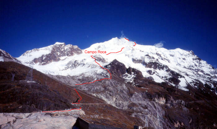
The way follows easy the pipe until a small lake. From there rightside up in 1:30 hours to Campo Roca at 5150m (no rocks there, when we were there only a lot of snow). From there in the early morning the track leads up a glacier in about 1:30 to the so called Campo Argentino (nobody seems to camp there) at the beginning of a great glacier bassin beyond the south face. From there its going up to the end of the bassin, climbing rightside up to the ridge crossing the bergschrund over an about 40m high 50° steep icewall. From there the path winds arround some hungry looking crevasses to the face of the final summit. There are two possible ways to finish, depending on the weather and snow conditions. |